


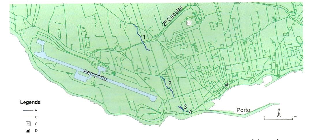
Located in the western part of the city of Ponta Delgada, “Gruta do Carvão” has a total length of about 2500 meters divided in three main sections and intermediate areas that collapsed and are obstructed, which physically separate these cavities not allowing full access to the primitive lava tube/tunnel.
For this reason, nowadays it´s only recognized and mapped an extension of 1912 meters of this lava tube which includes a Northern section (“Rua do Paim Cave” – Section 1), an intermediate section (“Rua de Lisboa, Secadores de Tabaco Cave” – Section 2), a Southern section (“Rua João do Rego Cave” – Section 3) and still the Rua José Bensaúde section, this last one with only 42,7 meters of length (Section a).
Nevertheless, as it was demonstrated before, some old documents, various historical reports and field works indicate far superior dimensions than the currently mapped for this volcanic cave, which could have reached up to 5km of total length (general orientation NNW-SSE) since coastline, in Santa Clara area, until the Serra Gorda proximities, in Arrifes, including the military zone that there exists.
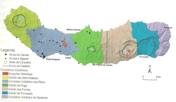
From the geological standpoint, Gruta do Carvão is located in the “Complexo Vulcânico dos Picos” an area composed by over 250 basaltic scoria cones and spatter (most of them located in the axial zone of this volcanic ridge) and by lava flows of basaltic nature that were drained towards the North shore and/or the South shore. These pyroclastic cones are aligned mainly according to fractures oriented NW-SE and E-W.
“Gruta do Carvão” develops in an extensive basaltic flow with general flux from North to South, which reached the sea in the western part of Ponta Delgada city and whose main vent is most likely located in Serra Gorda – Arribanas, in the Arrifes parish.
Today we can´t determine the age of the basalts associated to the “Gruta do Carvão”, though there´s an ongoing radiometric dating process using the 40Ar/39Ar method. However, this cave´s age is determined to be around 5 000 to 12 000 years old BP (Before Present) according to radiometric datings (14C) carried out by the Geochron Laboratory (USA) in carbonized vegetal materials (from Carvão´s Elementary School) collected from the paleosol under the lava flows of “Gruta do Carvão” that indicted ages of 11 880 BP (+/- 80) and 12 100 (+/-140). Additionally, this basaltic flow is covered by pumice pyroclastic materials (ash and lapilli) from Fogo volcano and “Fogo A eruption” with an approximate age of 4 550 years BP (Booth et al.).
Taking into account this reported data and the work of Booth and his collaborators it seems plausible to assign “Gruta do Carvão” to a Holocene age.