


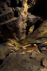
View of the interior of the "Gruta do Carvão" - "Paim" Section
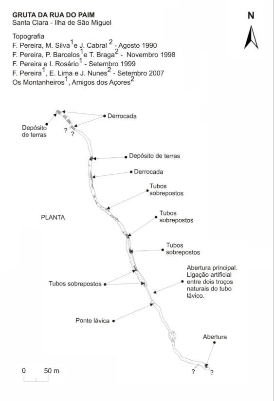
Topography of the "Rua do Paim" lava tube, the northernmost section of the "Gruta do Carvão" cave system (in “Catálogo das Cavidades Vulcânicas dos Açores”)
“Rua de Lisboa, Secadores de Tabaco” Section
This section is 701,8 meters long and for most of its extension it is comprised by a single tunnel with a NNW-SSE orientation that goes from Lisboa street (near the tobacco drying facilities of “Tabaco Micaelense”) until the intersection between Pintor Domingos Rebelo street (former Carvão street) and Antero de Quental avenue.
The medium height goes from 2 to 3 meters, though in some places it exceeds the 5 m and the medium width is 5 m reaching more than 10 m wide in the “Bairro da Misericórdia” area, where the two tunnels merge.
At some places of this section, rock walls have been built in order to reinforce the natural walls. These walls and remnants of an electric installation prove the human utilisation of this cave in the past. These walls can be best seen under the tobacco company buildings. This zone was used in the past as a materials deposit of the factory so it´s in some way altered and artificialized.
Recently, despite being crossed underneath by the lava tube, some terrains at surface have been urbanized (namely between “Bairro da Misericórdia” area and Carvão Elementary School).
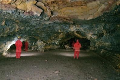
View of the interior of the "Gruta do Carvão"
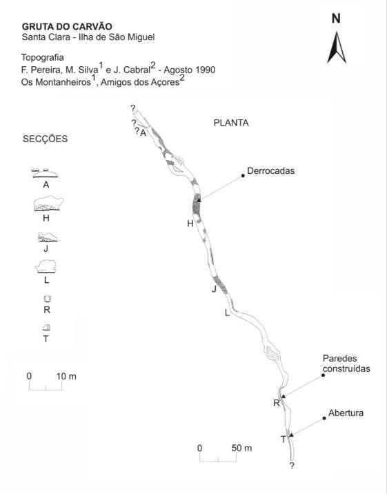
Topography of the "Rua de Lisboa , Secadores de Tabaco" section of the "Gruta do Carvão" (in “Catálogo das Cavidades Vulcânicas dos Açores”)
“Rua do João do Rego” Section
This part of the tube was recently rediscovered, in October 2000 during the sanitation works in “João do Rego” street, carried out by municipal services of the city council of Ponta Delgada.
This section consists of two fairly parallel branches with a NW-SE orientation that develop mainly under housing properties in the “João do Rego” street and the sugar factory “SINAGA” and also reaches some houses in the “1ª Rua of Santa Clara”. The oriental tube has a length of 100 m while the western tube is approximately 200 m long. These two branches meet below “João do Rego” street and continue as one only tube for a further 40 m with a N-S orientation.
In this section it´s possible to walk in almost all of its extension as it has a medium height of 3 m, reaching up to 6 m in some places, as for the maximum width it tops 13 m in the western branch. The roof of the tube is around 2 to 3 m below the surface.
Environmentally speaking, today this section of the “Gruta do Carvão” is considerably degraded and in a bad state of conservation, mostly due to the fact that it was used as a domestic waste disposal by the neighborhood and because it was structurally affected by the constructions in the surrounding area.
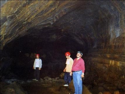
View of the interior of the "Gruta do Carvão" – "Rua João do Rego" section, during an expedition in October 2000
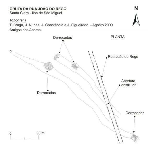
Topography of the "Rua João do Rego" tube, the southernmost section of the "Gruta do Carvão" cave system (in “Catálogo das Cavidades Vulcânicas dos Açores”)
“Rua José Bensaúde” Section
This section was rediscovered in the beginning of 1970 while the José Bensaúde street was being paved. This volcanic pit is the most downstream section of the “Gruta do Carvão” cave system.
The José Bensaúde pit is very diminished, it´s 42,7 m long, 5 m high and 7,5 m wide and has a vaulted ceiling. The general orientation of the pit is E-W.
It´s very likely that this section possesses a connection to the sea as the level of still water in there varies (up and down) depending on the sea level.
In February 1999, members of the “Grupo de Trabalho de Espeleologia dos Amigos dos Açores” were able to visit this section as it was accessible due to some major road works. However, it was not possible to proceed beyond the entrance because it was obstructed by fluvial sediments.~
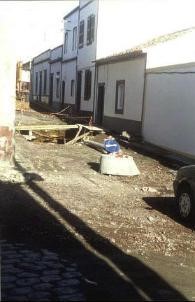
"José Bensaúde" pit entrance, during the sanitation works on the street with the same name, in 1999.
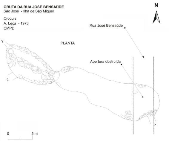
Topography of the "Rua José Bensaúde" volcanic pit (in “Catálogo das Cavidades Vulcânicas dos Açores”)